 |
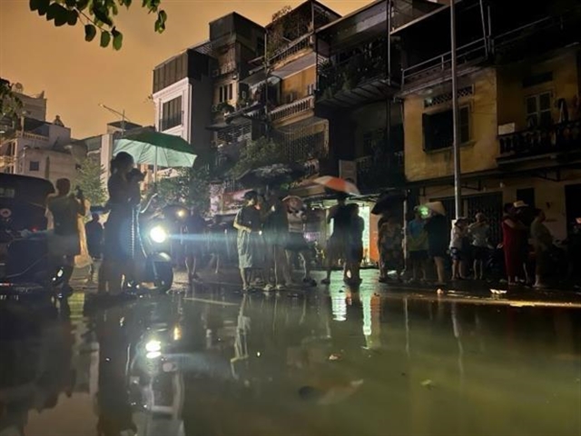
| Floodwaters from the Red River overflow onto Chương Dương Độ Street in Chương Dương Ward, Hoàn Kiếm District (photo taken at 11pm on 10 September). VNA/VNS Photo |
HÀ NỘI — Flood levels on the Red River in Hà Nội have surpassed Alert Level 2 out of three levels, triggering a level 2 natural disaster risk alert, according to a bulletin issued by the National Centre for Hydro-Meteorological Forecasting on early Wednesday (September 11).
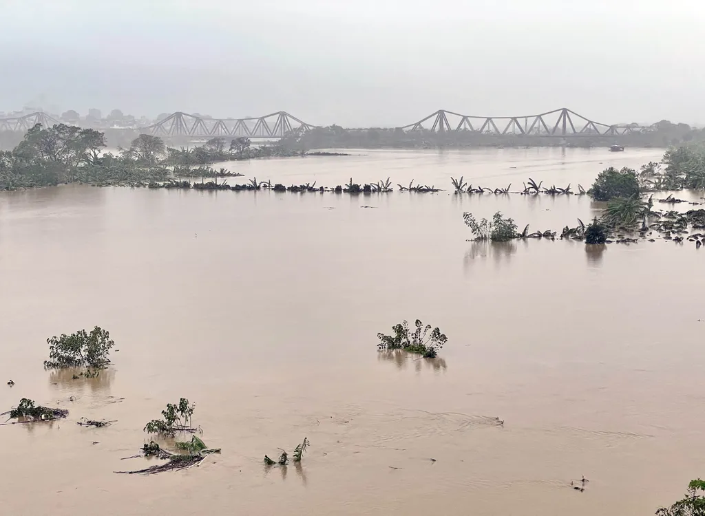
The water levels have been rising rapidly, with the Red River in Hà Nội reaching 10.54m at midnight, just 0.04m above warning level 2. The centre has forecast that the water level will continue to climb throughout the day.
By 1am on September 11, the river had risen to 10.6m, exceeding the second warning level by 0.1m. By 7am, it had further increased to 10.7m, 0.2m above the warning threshold. Projections suggest the water level will reach 10.75m by 1pm, and remain at this height into the evening.
Experts are warning of the potential dangers posed by these rising floodwaters, which could lead to widespread flooding and landslides along riverbanks. The safety of dykes in several districts, including Bắc Từ Liêm, Hai Bà Trưng, Đan Phượng, Phúc Thọ, Sơn Tây, Thanh Trì, Gia Lâm, Long Biên, Tây Hồ, Hoàn Kiếm, and Đông Anh, may be compromised. Authorities have classified the flood risk as level 2 on the natural disaster scale.
The elevated water levels have already led to significant flooding in low-lying areas, agricultural lands, fish farming zones, and residential areas. This poses a serious threat to daily life and the livelihoods of local residents, as well as to property in affected districts such as Đan Phượng, Phúc Thọ, Sơn Tây, Thanh Trì, Gia Lâm, Long Biên, Tây Hồ, Hoàn Kiếm, and Đông Anh. — VNS
 |
| Water swells on Red River, Hà Nội. — VNA/VNS Photo Minh Quyết |


