Typhoon Yagi weakens to a tropical depression, heavy rain warnings issued
Society – Economy - Ngày đăng : 10:55, 08/09/2024
 |
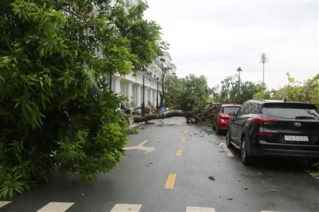
| A fallen tree in the modern urban area of Cầu Rào 2, Hải Phòng City. VNA/VNS Photo |
HÀ NỘI — According to the National Centre for Hydro-Meteorological Forecast (NCHMF), on the night of September 7, after moving further inland over the northern plains, Typhoon Yagi weakened into a tropical depression.
By 1am on September 9, the centre of the tropical depression is forecast to be at approximately 22.1 degrees North latitude and 101.8 degrees East longitude, over the highlands of northern Laos. The strongest winds near the centre will be below force 6, moving west-northwestward at about 15 km/h, and gradually weakening into a low-pressure system. Affected areas include the western part of the Gulf of Tonkin and northern Việt Nam, with a risk level of 3.
At sea, the Gulf of Tonkin (including the island districts of Bạch Long Vỹ and Cô Tô) will experience strong winds of force 6-7, with gusts up to force 9, causing rough seas.
On land, the inland northern regions will see strong winds of force 6-7, with gusts up to force 9. Waves in the Gulf of Tonkin (including Bạch Long Vỹ and Cô Tô) will reach heights of 2-3 metres. From the afternoon of 8th September, waves are expected to gradually subside.
In the northeastern region and Thanh Hóa, in the afternoon and evening of September 8, moderate rain and thunderstorms are expected, with localised heavy rain ranging from 20-50 mm, and some areas exceeding 100 mm. In the mountainous areas, heavy rain is forecast, with some areas receiving 60-120 mm, and isolated areas over 250 mm.
In the northwestern region, on the early morning of September 8 and 9, heavy to very heavy rain is expected, with rainfall ranging from 100-200 mm, and some areas exceeding 400 mm. This heavy rain may cause flooding in low-lying areas, flash floods in small rivers and streams, and landslides on slopes. VNS
