 |
| Tropical depression causes thunderstorms, strong winds and dangerous weather. VNAVNS Photo |
HÀ NỘI – Localities have been urged to ready themselves for any incoming storms, checking out drainage systems for obstructions and clearing water channels to reduce the possibility of urban flooding.
Deputy Minister of Agriculture and Rural Development, Nguyễn Hoàng Hiệp, has issued a warning about the complex developments of natural disasters and called for proactive measures from ministries, sectors and localities.
The Ministry of Agriculture and Rural Development (MARD) on Monday held a meeting to address the response to the tropical depression and heavy rainfall, chaired by Deputy Minister Hiệp.
To cope with the upcoming natural disasters, especially heavy rainfall, Hiệp urged affected areas to review drainage, mobilise functional forces to check and remove obstructions and clear water channels to reduce urban flooding.
Localities affected by the low-pressure system and its remnants must be cautious of flash floods and landslides to minimise their impact on people's lives and production.
"Tropical depression may weaken, but coastal areas should be on alert for heavy rain and thunderstorms," said Hiệp.
He also requested the Directorate of Water Resources to review all irrigation reservoirs and direct localities to timely drain water in case of flooding situations.
Addressing future natural disaster scenarios, Hiệp highlighted the need for ministries, sectors and localities to closely monitor forecasts and warnings from the National Hydro-Meteorological Forecasting Centre and the actual situation locally to be proactive in response.
"Following the severe landslide in Hà Giang Province on July 13, functional agencies should research and increase advisories against nighttime travel, particularly during the rainy season,” the deputy minister said.
“If conditions such as traffic, embankments, and natural disasters are deemed unsafe, authorities should enforce bans on people and vehicles in dangerous areas, especially at night," he added.
Furthermore, he urged localities to intensify inspections and prepare contingency plans to ensure the safety of reservoirs and downstream areas, especially small hydropower plants and vulnerable irrigation reservoirs.
He also recommended stationing forces to operate and handle situations as they arise.
Tropical depression weakening but causing heavy rain
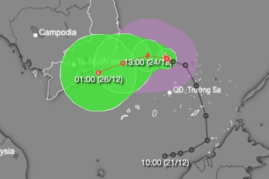
Hoàng Phúc Lâm, Deputy Director of the National Centre for Hydro-Meteorological Forecasting, reported that the tropical depression is moving west-northwest at a speed of about 10km per hour, with wind speeds reaching level six (39-49 km per hour) and gusts up to level eight.
By 7am on July 16 the tropical depression is expected to move west-northwest at about 15km per hour and gradually weaken into a low-pressure area.
Due to the tropical depression, the northwest part of the centre of the East Sea and the southwest part of the north of the East Sea (including the Hoàng Sa Archipelago) and the offshore areas from Quảng Bình to Quảng Ngãi provinces will experience heavy showers and strong thunderstorms, with winds reaching level six and gusts up to level eight, causing rough seas.
The offshore areas from Bình Định to Cà Mau provinces, the south of the East Sea including the Trường Sa (Spratlys), will have strong winds reaching level six and gusts up to level eight-nine.
The Gulf of Tonkin will have strong winds at level five, occasionally reaching level six, causing rough seas.
Until July 17, due to the influence of the tropical depression and its remnants, the Red River Delta and northern coastal areas, Tây Nguyên (Central Highlands), and the southern region will receive rainfall ranging from 50-100mm, with isolated places receiving over 200mm.
The northern and central Central regions will receive 70-150mm of rainfall, with isolated places receiving over 250mm.
There is a risk of flash floods and landslides in the northern mountainous region, the north-central region, and southern Tây Nguyên.
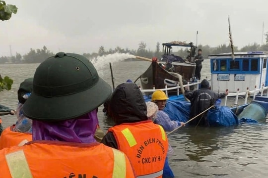
As of 6am Monday, the Border Guard Command reported that the Border Guard forces tracked and guided 40,146 boats with 196,741 people to avoid the tropical depression, including 1,037 boats with 6,187 people operating in the sea area from Quảng Trị to Quảng Ngãi provinces and the Hoàng Sa area.
Thừa Thiên-Huế Province banned any activity at sea since the afternoon of Sunday.
Airports affected by tropical depression
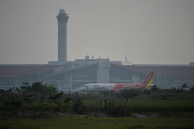
The Việt Nam Air Traffic Management Corporation (VATM) is closely monitoring the weather developments due to the tropical depression, which have been impacting several airports and issuing warnings during flight operations.
Due to the influence of the tropical depression, many airports across the country were affected by heavy rain and strong thunderstorms, limiting visibility.
According to a report from VATM, at around 10-11pm on Sunday, the tropical depression entered the mainland in the area from Thừa Thiên-Huế to Quảng Trị provinces then weakened into a low-pressure area (below level six) over central Laos.
The tropical depression affected sectors 1, 4, and 5 in the HCM City Flight Information Region (FIR) and sectors 3 and 4 in the Hà Nội FIR, with thunderstorms, rain and other hazardous weather phenomena such as moderate to severe turbulence and aircraft icing.
Notably, on Sunday evening, Vinh and Đồng Hới airports experienced thunderstorms and strong winds while Đồng Hới, Phú Bài, Đà Nẵng, and Chu Lai airports on Monday experienced heavy rain and strong thunderstorms, with visibility ranging from 2,000-4,000m.
At Đà Nẵng Airport, the visibility occasionally dropped to 1,500m in heavy rain and strong thunderstorms, with strong gusts.
To prevent and minimise damage caused by the tropical depression, the VATM’s Aviation Meteorological Centre has directed its subordinate units to continuously monitor the developments and activities of the tropical depression, analysing various meteorological data such as satellite images, weather radar, and exchanging weather information with meteorological agencies in Japan, China's Hong Kong, the Philippines and Singapore.
This information is used to make decisions on forecast content and warnings affecting aviation activities and equipment at airports, providing early plans for safe flight operations and proactive measures to mitigate the impacts of the tropical depression. VNS


