 |
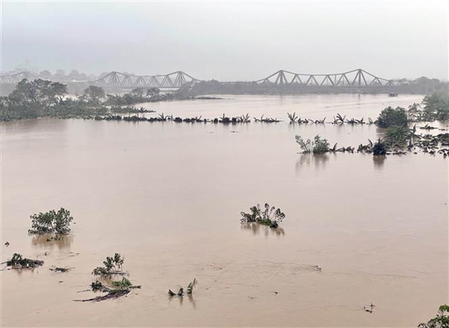
| The water levels of the Red River in Hà Nội are the highest they have been for 20 years. — VNA/VNS Photos |
HÀ NỘI — Torrential rain, combined with continuous rising levels of the Red River on Wednesday, caused severe flooding in some streets and urban areas in Hà Nội, significantly affecting the lives and livelihoods of many residents.
Areas such as Mỹ Đình 2 in front of the Phú Mỹ village gate, Kẻ Vẽ near Vẽ market, Triều Khúc, Cầu Bươu from K Hospital to Yên Xá Canal, Thăng Long Avenue in the intersection with Lê Trọng Tấn, and the Yên Nghĩa underpass from Yên Nghĩa Bus Station to Ba La intersection were all submerged.
The downpour also led to flooding on various downtown streets, making traffic challenging. By around 7am on Wednesday, the Pháp Vân – Cầu Giẽ Expressway in Duyên Thái Commune in Thường Tín District was flooded in both directions, hindering traffic and posing a threat to many vehicles, particularly cars with low ground clearance.
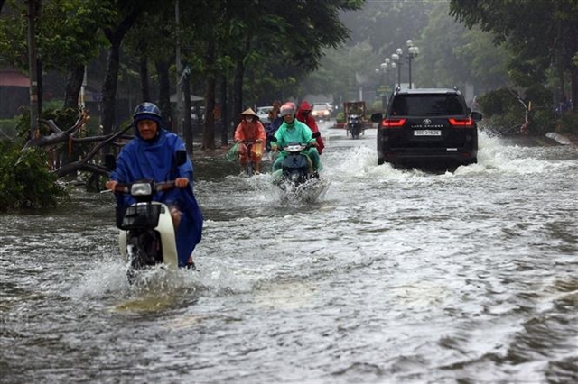 |
| Drivers make their way through the water in Văn Quán Ward in Hà Đông District on Wednesday. |
Additionally, the large volume of rainwater overwhelmed drainage systems, resulting in severe flooding in urban areas and apartment complexes like Geleximco Area A on Lê Trọng Tấn in Hoài Đức District and Ecohome 3 in Bắc Từ Liêm District.
Đặng Văn Tuân, a resident of An Khánh Commune in Hoài Đức District, said that many families were using sandbags and other materials to try and block water from entering their homes. Several cars, especially those with low clearance, were submerged and many properties had been damaged.
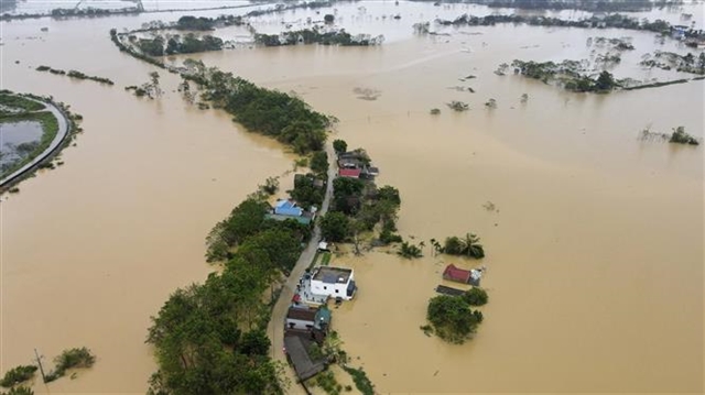 |
| Nhân Lý Village in Nam Phương Tiến Commune, Chương Mỹ District is covered by floodwater. |
According to the Director of the National Centre for Hydrometeorological Forecasting, Mai Văn Khiêm, the water level of the Red River in Hà Nội reached 11.1 metres at 11am on Wednesday.
This marks the highest flood level in 20 years, since 2004 when the river rose to 11.04 metres.
By Wednesday afternoon, the flood level in Hà Nội is expected to rise further, reaching 11.3 metres, just 20cm below the third warning level.
While floodwaters may begin to recede tonight, the decrease will be very slow.
Additionally, local rivers such as the Bùi, Tích, and Cà Lồ have all exceeded the third warning level, prolonging the risk of widespread flooding in areas along the rivers and dikes in Hà Nội for at least the next three days.
Evacuation of Phúc Xá residents
On Wednesday morning, Tạ Nam Chiến, chairman of the Ba Đình District’s People's Committee, reported deep flooding in some areas of Tân Ấp Street, part of Nghĩa Dũng Street, and Phúc Xá Street in Phúc Xá Ward.
To reduce risk, the People's Committee of Phúc Xá Ward has advised residents living near the river to move their belongings and prepare for evacuation if emergency orders are issued. The ward has also requested boats and ships to help people relocate and prevent accidents and ensure that any necessary rescue operations are not hindered.
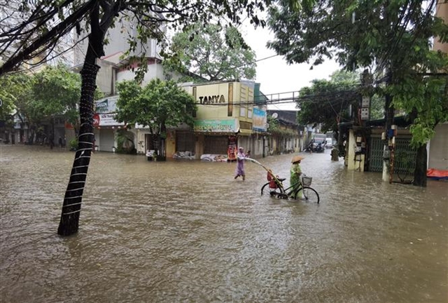 |
| Tân Ấp Street, Phúc Xá Ward, Ba Đình District is submerged. |
The committee has also warned residents to stay away from riverbanks and dikes along the Red River, as the area is dangerous with strong flood currents. It emphasised that people should not swim or fish in the river during rising floodwaters and tourism activities in these areas have been temporarily suspended.
It has informed residents needing assistance with relocation to contact the ward's Natural Disaster Prevention and Search and Rescue Command. Households in the affected areas are urged to closely monitor flood updates, heed warnings and follow local government directives.
According to the Ba Đình District People's Committee, 276 households with 1,059 residents living in the at-risk areas along the Red River in Phúc Xá Ward were evacuated to the Vocational and Continuing Education Centre at 67 Phó Đức Chính Street in Trúc Bạch Ward on Tuesday night.
The committee has instructed the Ba Đình Power Company to closely monitor areas near the river, implement power cut plans in flooded areas and cut electricity to affected households and substations to ensure safety.
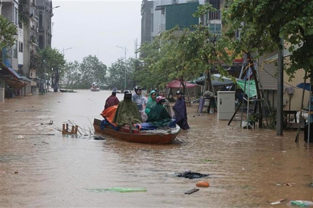 |
| Residents in Chương Dương Độ Road in Hoàn Kiếm District are forced to use a boat to move through the floodwaters. |
On Wednesday morning, chairman of the Hoàn Kiếm District’s People's Committee Phạm Tuấn Long announced that the committee inspected and directed relevant units, wards and residents to focus all resources on flood prevention efforts for the two wards of Chương Dương and Phúc Tân, where the water level of the Red River has risen significantly.
The district has organised notifications and encouraged the evacuation of 379 households across these two wards.
Ensuring safety for residents living outside the Red River dike
On Wednesday morning, Phạm Văn Minh, chairman of the Sóc Sơn District People's Committee reported that the flooding situation affecting residents along the banks of the Cầu and Cà Lồ rivers is quite complex.
According to preliminary statistics from the district People's Committee, approximately 3,311 households with 15,673 people have been affected by the flooding, which has also hit around 167 hectares of rice, crops and aquaculture.
Emergency response efforts are underway.
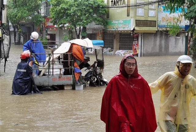 |
| Residents living along the Red River wade through floodwater. |
Elsewhere there has been a breach and erosion of the embankment at Đầm Khoai in Cầu Lai Hamlet, Lai Son Village, Bắc Sơn Commune, along a width of approximately 5-6 metres. Water from the Cầu Lai stream overflowed, flooding around 12 hectares of agricultural land.
The district has mobilised troops from Regiment 209, Division 312 to assist residents in harvesting crops to minimise losses. — VNS


